


Traveler’s Guide: Public Transit, Biking & Walking Made Easy
June 29, 2026
Boston is the kind of city where walking a few extra blocks is part of the fun. From the historic Weeks Footbridge to the intellectual energy of Harvard Square and long walks along the Charles, if you’re visiting Boston, there’s a good chance you’ll be moving around. From The Atlas Hotel in the Allston neighborhood of Boston, you can skip the car and keep things effortless.
This guide covers getting around Boston without a car, and will help you navigate public transit, biking, and walking through the city.
What You’ll Learn in This Guide
- How to get from Logan Airport to The Atlas Hotel
- How to get around from Allston neighborhood of Boston without a car, including the easiest ways to reach downtown, Back Bay, Fenway, and Cambridge
- Which MBTA options make the most sense from The Atlas, including Green Line (B Branch) stops and Route 66 for Harvard Square
- Three walking routes worth doing near The Atlas, with ideas for food, shops, museums, and scenic detours
- How to use Bluebikes and the Charles River paths for a ride that gets you to Kendall Square and beyond
- How to plan for big-event days, including commuter rail to Foxborough when special service is offered
- Why The Atlas is a strong car-free home base, including dining, rooftop drinks, and a lobby that works for meetups or getting things done
Why Boston is Easy to Explore Without a Car
Boston is made for car-free exploring. The city’s compact layout, historic streets, and walkable neighborhoods make it easy to build full days without thinking about parking—especially from Allston. From The Atlas Hotel, you’re close to Harvard University, Boston University, Northeastern University, and MIT with easy rides to Cambridge, downtown, Back Bay, and Fenway.
How to Get Around Boston by Public Transit (MBTA)
If you want to cover more than one neighborhood in a day, the T and buses make it doable—especially from Allston, where you can connect to major neighborhoods quickly. The MBTA Green Line (B Branch) is a go-to for visitors, with commonly used Allston-area stops like BU West and Harvard Avenue serving as convenient jump-off points.
From these stops, you can reach downtown, Back Bay, and Fenway for museums, shopping, dining, sporting events, and concerts. For Cambridge, MBTA buses are often the right move—Route 66 connects Harvard Square with the Allston/Brighton area.
Transit-friendly itinerary starters:
- MBTA from Logan Airport to The Atlas: Take the Silver lines (SL 1) from the airport to South Station, from South Station take the Red line to Central Sq. to the 70 bus route which drops you just steps from The Atlas Hotel
- MBTA from Allston to Downtown through Boston: Take the Green Line (B Branch) toward Kenmore, then continue on for downtown connections.
- MBTA from Allston to Downtown through Cambridge: Route 66 is the simplest connector to Harvard Square, with easy onward access to Cambridge. The Red Line in Harvard Square is a convenient direct route through MIT/Kendall Square into Downtown Crossing.
Once you’ve got transit covered, here are the walks worth doing.
Walking Routes Worth Taking Near The Atlas Hotel
Even on foot, you can cover a lot of ground nearby, especially in Allston, where the neighborhood energy is part of the appeal. From The Atlas, you can build walks that feel like mini-itineraries: campus, cafés, scenic bridges, and more.
Quick ideas for exploring on foot from The Atlas:
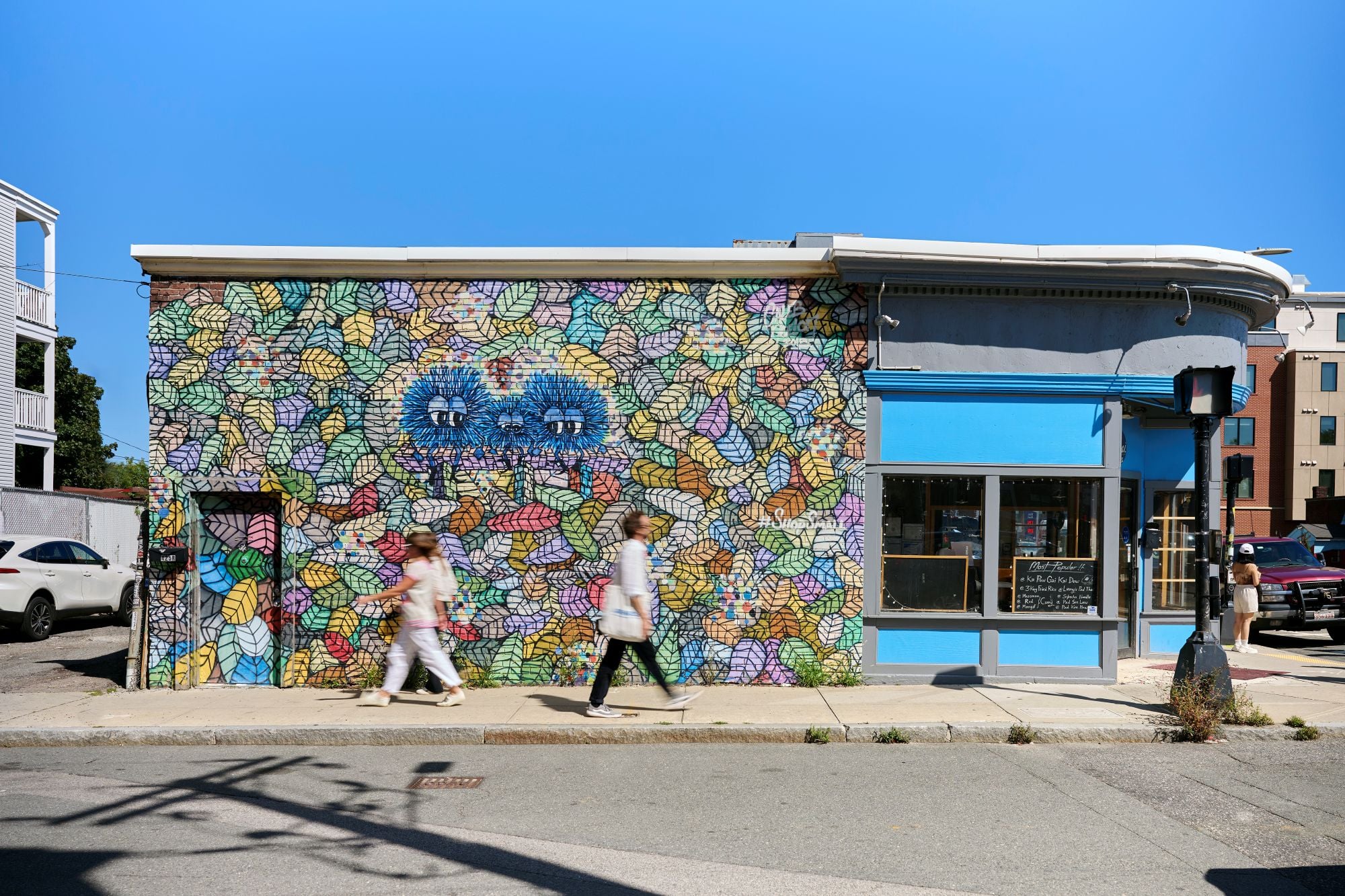
- Allston Art Walk: A self-guided mural-and-public-art loop through Allston Village—an easy way to catch the creative energy of the neighborhood.
- Harvard Square: A classic trip to one of the most dynamic and historic neighborhoods in Cambridge.
- Harvard Avenue/Allston Village: A browse-and-bite route—coffee, local shops, and casual stops that can turn into a full, easygoing afternoon.
- BU/Kenmore Square/Fenway: A classic Boston walk—campus energy into Kenmore’s crossroads, that can easily extend into Fenway for food, museums, or a day at the ballpark.
- BU Bridge/Cambridge/Kendall Square: A scenic cross-river stroll into Cambridge, with Kendall Square as a natural finish for cafés and museums. Then take transit back to your home base.
Walking route: Allston Art Walk (Allston Village loop)
If you want a walk with built-in stops, follow the Allston Art Walk—a self-guided route of murals and public art around Allston Village. It’s perfect for a low-pressure afternoon: walk, stop for photos, then grab a coffee or bite on Harvard Ave as you go.
Walking route: Harvard Square
Walk across the street into Harvard Business School along Batten Way and turn left at the rotary and continue until the end of the street in front of the Harvard Stadium, then turn right on North Harvard Street. Continue walking across the bridge and you will reach the fun Harvard Square.
Walking route: Allstonway/Harvard Ave/BU
Start by heading out to Allstonway, the art-and-greenspace corridor just outside The Atlas that leads you toward the Charles. From there, turn it into a classic Allston morning. Grab coffee and breakfast at @UNION, then swing by Café Brazil for something sweet (try their cinnamon roll or doce de leite). After, wander Harvard Avenue for neighborhood shops and quick bites before continuing toward Boston University for a campus stroll.
Want the scenic version? After Harvard Ave, angle toward the Charles River paths and follow the water toward Cambridge. The views do a lot of the work, and it’s a great sightseeing route.
Walking route: BU/Kenmore Square/Fenway
Head toward Boston University for a campus walk, then keep going until the neighborhood shifts into Kenmore Square—one of those Boston crossroads where you can plan your next move. Maybe flip through vinyl at Nuggets (a longtime Kenmore Square record store), pick up some fun reading material at Comicopia, or make it a museum day at the Museum of Fine Arts, Boston, or the Isabella Stewart Gardner Museum. And, of course, if you’re a baseball fan, you’re just steps from one of the great cathedrals of the game, Fenway Park.
Once you hit Kenmore/Fenway, you’ve got quick, very Boston dining options:
- Tatte Bakery & Café for pastries and a sit-down break
- Time Out Market Boston if your group can’t agree on one thing to eat (lots of choices in one place)
- El Jefe’s Taqueria for tacos, burritos, and late-night bites
Walking route: BU Bridge/Cambridge/Kendall Square
Take the BU Bridge into Cambridge for river views on the way and plenty to explore once you’re across. On the Cambridge side, you can keep it scenic by sticking to the river, or make it a destination walk by continuing to Kendall Square. This is a great place to stop—especially if you want an indoor, educational break. There are excellent museums in this area, including:
- MIT Museum for interactive exhibitions that blend science, tech, art, and design—check what’s on during your visit.
- Museum of Science for crowd-pleasers like the live Lightning! show in the Theater of Electricity, plus the Charles Hayden Planetarium and Mugar Omni Theater.
Boston Bluebikes Guide
Bluebikes are an easy way to cover more ground in Boston without giving up the scenery. You’ll find stations around Allston and BU, and there are great bike routes near Boston University that connect quickly to the Charles River paths.
New to Bluebikes? Here’s how to use one:
- Grab a bike from any Bluebikes station
- Unlock it through the Bluebikes app
- Return it by docking at any station when you’re done
For a low-stress ride, head straight to the Charles. From there, river paths make for a scenic route that can carry you toward Kendall Square and onward toward downtown. This is the kind of route that’s perfect for a morning loop or relaxed afternoon ride.
Safety tips:
- Wear a helmet whenever you’re biking
- Use lights at dusk and after dark
- If you’re new to city biking, start with river paths before busier streets
- Dock the bike and walk the last few blocks in high-traffic areas if needed
Eco-Friendly and Accessible Travel for Students and Visitors
Going car-free in Boston isn’t just convenient—it’s a practical way to travel more sustainably. Walking and biking reduce your footprint, and public transit helps cut down on congestion in busy areas around campuses and tourist hubs. It also tends to save money: fewer ride-shares, no garage fees, and less time lost to parking logistics.
Accessibility matters too. The city continues to expand and improve accessible routes and stations, and ride options (including buses and rail where available) can help visitors who prefer fewer walking miles. A good approach is building days around different neighborhoods—take transit to an area, see the sights, then transit back to The Atlas and explore somewhere new the next day.
Whether you’re here for campus visits or a city weekend, car-free travel keeps the day lighter on your budget, your schedule, and the city itself.
Visiting for Major Events in Boston 2026
Boston will be a major hub for international soccer in summer 2026, with matches hosted at Boston Stadium in Foxborough and plenty of fan energy throughout the city. If you’re visiting during a match week, staying at The Atlas Hotel in Boston gives you more flexibility: neighborhood exploring by day, then a stadium plan when it’s game time.
From The Atlas, you can build a transit-forward approach. You can find MBTA connections within the city, and Commuter Rail to Foxborough when it’s offered for major events (service details depend on the specific match or event date). Downtown, watch for official announcements about viewing parties and fan events in central public spaces, so you can catch the atmosphere even if you don’t have tickets.
For stadium days, plan ahead and check the latest MBTA/Commuter Rail event service options for Foxborough close to your date.
For more happening around town during your stay, check The Atlas Hotel’s events calendar.
Why Stay at The Atlas Hotel for a Car-Free Boston Visit
The Atlas is a great fit for a car-free stay: you’re in a location that’s well-positioned for MBTA access, walkable Allston routes, and connections toward the river and Cambridge. It’s ideal for travelers who need modern accommodations and want to spend most of their time out in the city—not figuring out how to get around it.
One more reason The Atlas works so well for a car-free trip? You can have a great night without going anywhere. Ama at the Atlas serves up bold, globally inspired flavors with a nod to Nepalese traditions, plus views out to Allstonway.
Then take it upstairs to Foxglove, our rooftop bar opening spring 2026. It’s made for conversation, a drink, and a view—plus programming that spotlights local artists. And if you’re meeting friends before heading out—or knocking out a few emails—the Living Room Lobby is a place to land for coffee, casual catch-ups, or a little work between plans.
A Stay in Boston is a Walk in the Park with The Atlas Hotel
Whether you’re in town for matches, concerts, campus visits, or a long weekend, The Atlas keeps Boston close. There are quick routes to the places you came to see, and a comfortable landing spot when you’re ready to come back.
Explore our limited-time offers and exclusive rates, and start planning your stay at The Atlas today.
Yes. Boston’s neighborhoods are compact and well connected by walking routes, transit, and river paths, especially if you’re staying in an area like Allston with multiple ways into the city.
For many visitors, MBTA bus routes are the simplest option. Route 66 is a popular connector between the Allston/Brighton area and Harvard Square.
Yes. The Green Line (B Branch) is a common way to reach Fenway-area stops, and walking is also doable depending on your pace and plans.
They can be, especially if you stick to river paths and lower-stress routes. Start with a daytime ride along the Charles before trying busier streets.
For certain major events, commuter rail service may be offered. Check MBTA service updates close to your event date to confirm whether special trains are running.
Yes—between the onsite restaurant (Ama), the rooftop bar (Foxglove), and the Living Room Lobby, you can keep your evening (or your pre-night-out plan) entirely in-house.